
Research and experimentation with uncrewed systems allows NOAA to improve and expand the ways that critical, accurate and time-sensitive data can be gathered and used. NOAA researchers and their partners use simulated and real-world experiments to assess the impact of uncrewed systems technologies and the data they collect. This information is then used to integrate uncrewed systems into NOAA operations.
Take a closer look at the following projects that NOAA’s Uncrewed Systems Operations Center supports that highlight the value of experimenting with uncrewed systems and associated data.
Simulating uncrewed aircraft operations to assess impacts on weather forecasting
Researchers at NOAA's Global Systems Laboratory, the University of Colorado-Boulder and the University of Nebraska–Lincoln use Observing System Simulation Experiments to determine what configuration of uncrewed aircraft could best support NOAA’s weather observation needs. NOAA then uses the simulation experiments to explore the use of uncrewed aircraft in enhancing weather forecasts.
Instead of purchasing and deploying uncrewed aircraft to determine the value of autonomous observations, this project team uses NOAA’s Research and Development High Performance Computing System to simulate data from uncrewed aircraft and evaluate the impact of the data on weather forecasts. Early results suggest that installing less than 100 uncrewed aircraft profiling sites across the United States would produce a noticeable improvement in Numerical Weather Prediction forecast models.
Developing technology to address data gaps
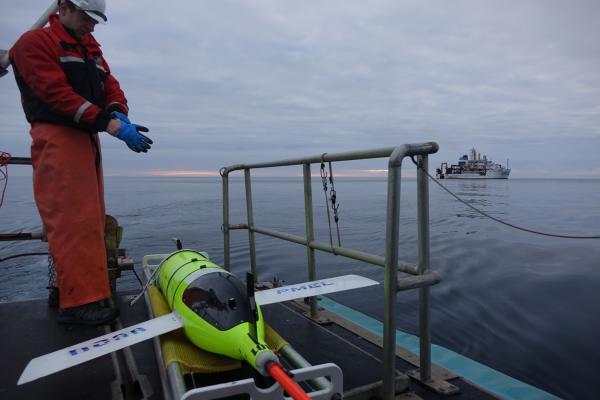
Through the Innovative Technology for Arctic Exploration Program, NOAA worked to advance Arctic observing and support environmental, economic and national security interests. One of the program’s flagship projects was the development of the Oculus glider. The Oculus is an underwater glider that samples across diverse environmental conditions in freshwater and shallow ocean regions that are challenging for traditional observing platforms. In its preliminary Arctic field tests, the glider provided first-of-its-kind observations of ocean conditions in the Bering Sea. Since then, NOAA worked with experts at the University of Washington and industry partners to operationalize the technology for NOAA’s Arctic research. NOAA’s glider-technology development contributes to technological advances while filling gaps in ocean observing.
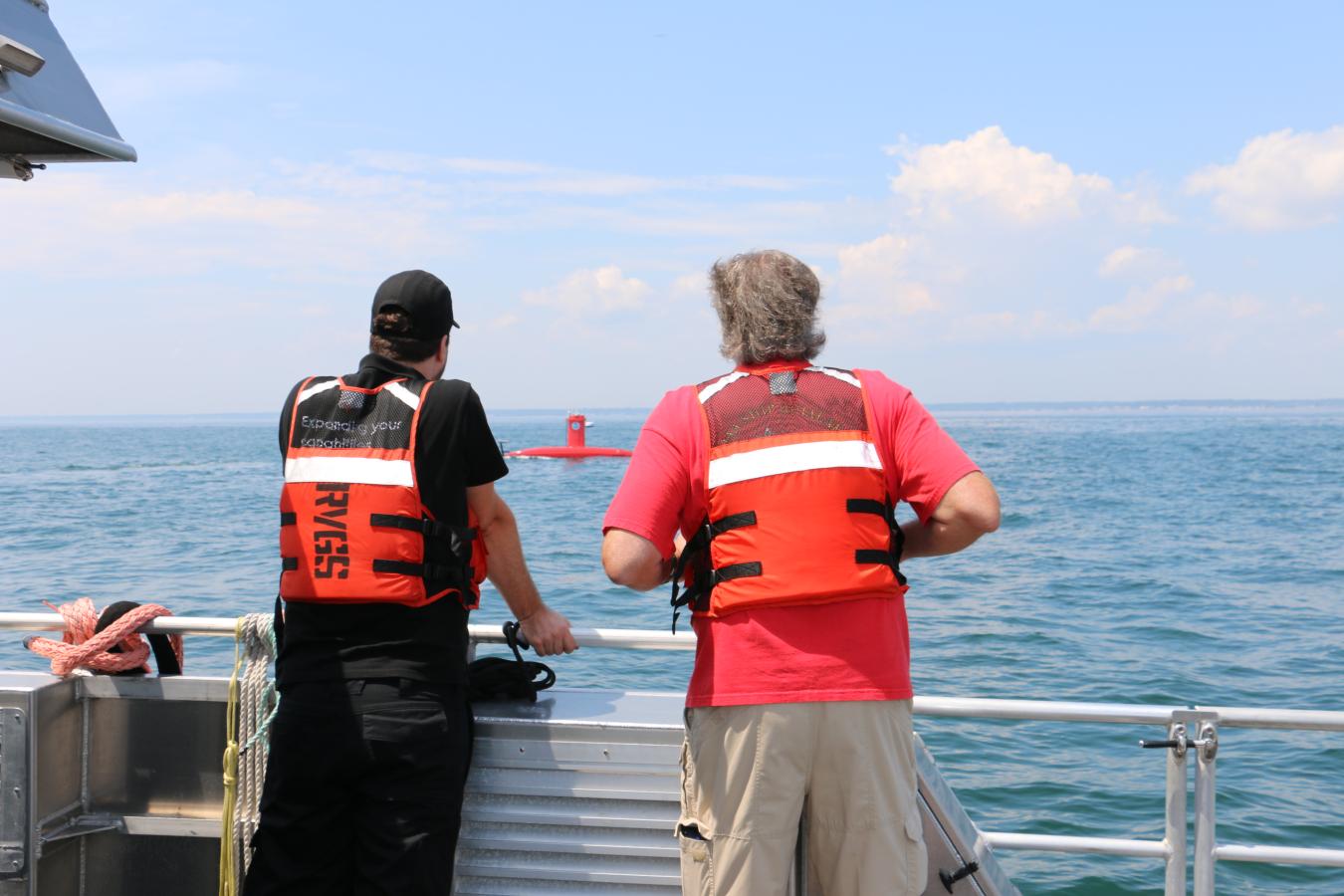
Gathering ocean observing data
Through formal agreements with universities like the University of Southern Mississippi and Scripps Institution of Oceanography, NOAA and partners have tested multiple uncrewed systems to augment the agency’s ocean observation capabilities. Partnering with academia allows NOAA to work with technical and scientific leaders to explore uncrewed systems applications before making larger investments in new platforms. This collaboration allows for experimentation with different uncrewed marine systems in gathering environmental data. The results direct future NOAA investments in uncrewed marine system technologies.
Testing life-saving satellite services
NOAA satellites and data are used by the international satellite system to transmit distress signals from emergency beacons. These beacons are aboard airplanes and vessels, and carried by individuals around the world. In the United States, NOAA is part of the Search and Rescue Satellite-Aided Tracking (SARSAT) Program.
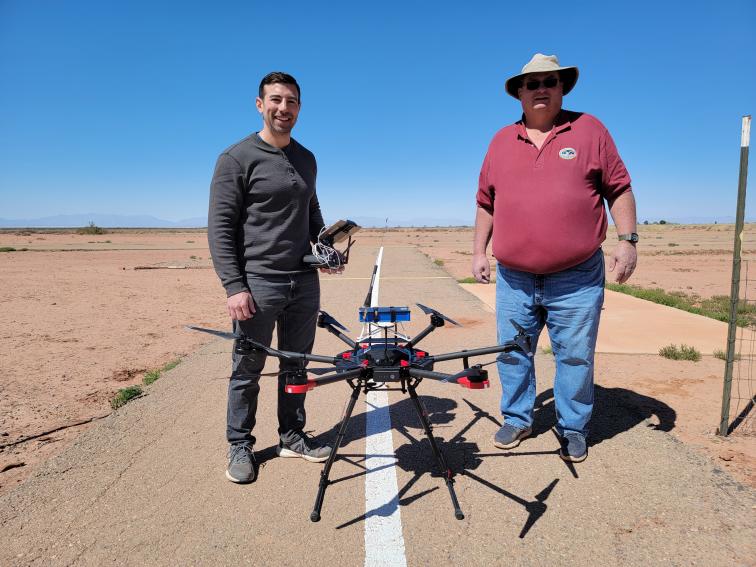
In order to maintain the functionality of the emergency response system, the SARSAT Program commissions new ground stations and calibrates existing ones to transmit distress signals. The SARSAT Program collaborated with the Uncrewed Systems Operations Center to determine if an uncrewed aircraft could support commissioning of new ground stations that support emergency-beacon detection. The team equipped a NOAA uncrewed aircraft with an emergency beacon and located the platform as it flew around a new station in New Mexico. Given the effectiveness of the test runs, SARSAT plans to fly uncrewed aircraft to commission future new ground stations in Hawaii, Florida and Guam to contribute to the accuracy of the