
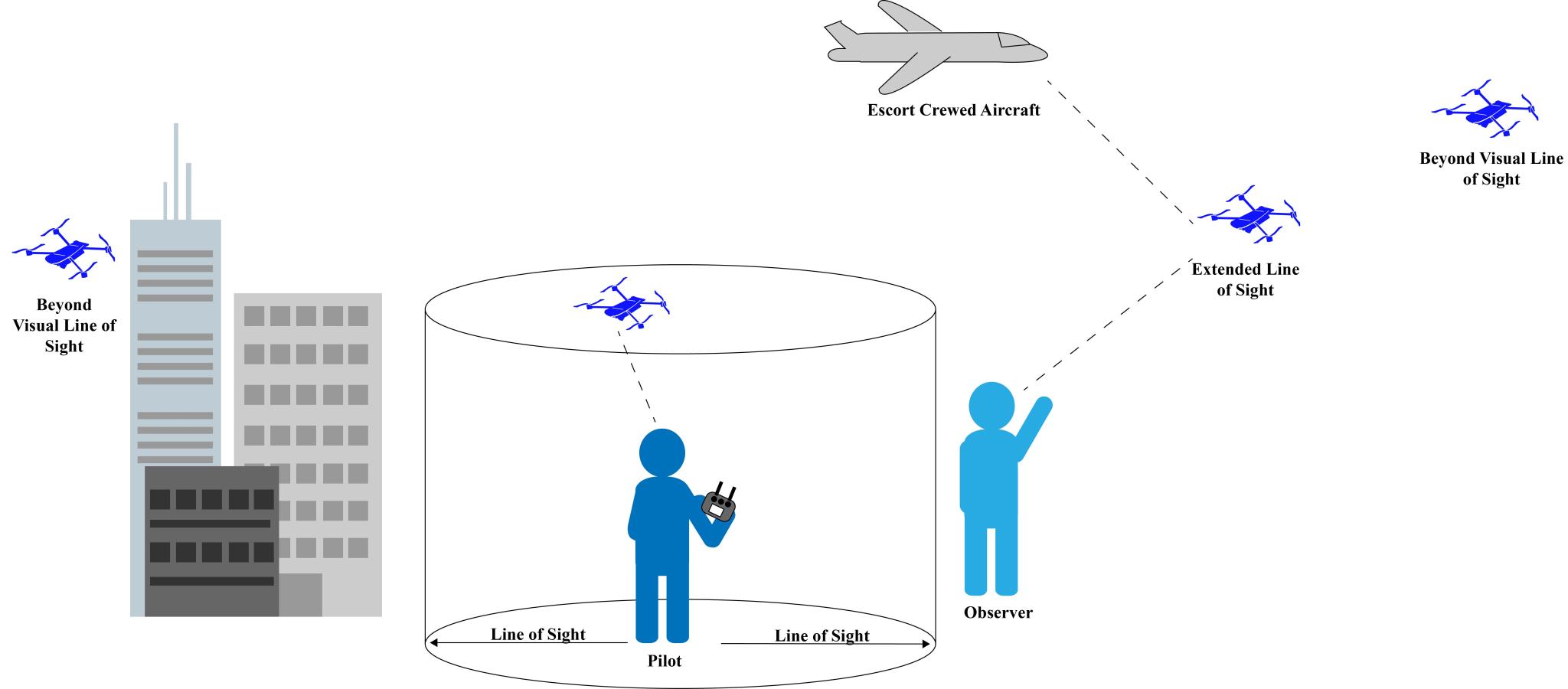
In the United States, uncrewed flight operations are regulated by the Federal Aviation Administration (FAA)– the same agency that regulates crewed aircraft and any activities in U.S. airspace. To maintain a safe airspace and surrounding area, any drone or other uncrewed aircraft flown in the U.S. must perform operations within visual line of sight of the operator, per FAA regulations. Many factors can influence visual line of sight distance such as the uncrewed aircraft’s size and speed, weather conditions, time of day, and physical obstructions.
At NOAA, all uncrewed aircraft operations are required to conduct operational risk management assessments and receive flight authorization that are compliant with FAA and NOAA-specific regulations. In this authorization process, NOAA personnel work with the NOAA Uncrewed Aircraft Systems Division to establish visual line of sight parameters.
NOAA scientists are always looking for ways to increase their ability to collect data and meet NOAA mission requirements, One way to enhance this ability is to fly uncrewed aircraft operations “beyond visual line of sight” (BVLOS, the pilot and other observers can no longer visually see the uncrewed aircraft). The FAA can grant approval to fly BVLOS, on a case by case basis, depending on the risks of the operation.
To gain BVLOS-approval, considerations such as safety, social and environmental benefits, and the ability to mitigate risk are taken into account. NOAA uncrewed aircraft operators and the Uncrewed Aircraft Systems Division have successfully been granted FAA-approval to fly BVLOS in remote environments and at altitudes well above commercial/crewed flights. In doing so, NOAA is able to gather data efficiently and safely, in remote regions that would otherwise not be sampled. The Uncrewed Aircraft Systems Division continues to coordinate with the FAA and work to develop NOAA’s BVLOS capabilities. Check out the below examples of how the uncrewed aircraft of NOAA’s fleet have enabled NOAA science.
Flights at the Edge of Space
For example, the NOAA Global Monitoring Lab obtained FAA-approval to fly their uncrewed aerial glider BVLOS at altitudes of 90,000 feet in northeastern Colorado. The glider, assisted by a standard weather balloon, carries sensors and air sampling technology to the edge of space and allows for atmospheric monitoring to occur at altitudes crewed aircraft cannot reach. The glider can then be programmed to return to a specific location. They demonstrated the success of this BVLOS uncrewed operation in the summer of 2023.
Flights at the Ends of the Earth
NOAA has also participated in BVLOS operations in the Arctic and Antarctic, regions that can be difficult or dangerous to access, but are home to federally protected species that must be monitored. In the Arctic, NOAA is partnering with NASA to fly their long-range, fixed-wing uncrewed aircraft BVLOS to monitor marine mammal populations in areas that are logistically challenging and higher risk to survey via crewed flights. In the Antarctic, NOAA fly BVLOS flights to increase the extent that researchers can cover for penguin population surveys. In both these instances, BVLOS flights enhance NOAA researchers’ abilities to gather more data safely and efficiently.
Flights for Extended Periods of Time
With the right uncrewed technology and flight environment, NOAA is also able to increase the length of their sampling period through BVLOS operations. The NOAA Pacific Marine Environmental Lab is exploring the use of uncrewed systems –capable of flying for over five hours while carrying science payloads– to develop more efficient and extended ways to sample aerosol and cloud properties. Increased measurements support NOAA’s mission to understand changes in climate and weather, along with Earth Radiation Budget research.